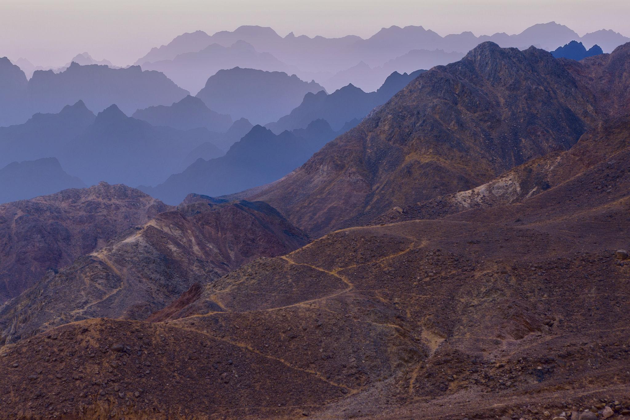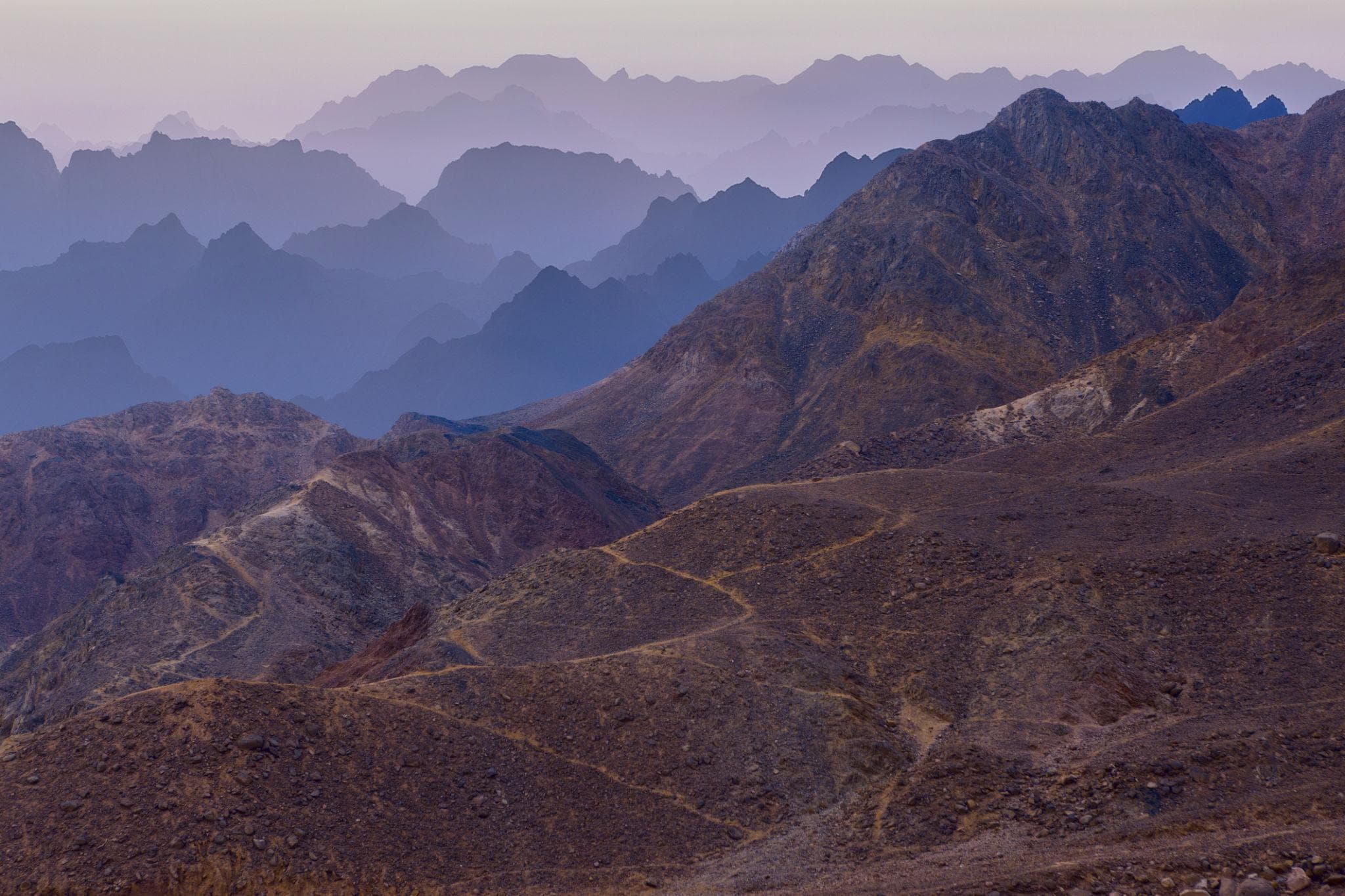
The road inland from Dahab climbs for about two hours through bare granite before it sets you down in a town at 1,586 metres above sea level, where pipes freeze in February and snow is not unusual. This is the other Sinai: not the reef-and-resort strip on the Gulf of Aqaba, but a high interior of red and grey mountains, dry wadis, Byzantine orchards and Bedouin tribal territory, holding ground higher than anything in the Western Desert.
Most visitors meet it for about six hours. They arrive at one in the morning, walk up Mount Sinai in the dark, watch the sun come up, glance around the monastery and are back at the coast by lunch. That works, and the sunrise earns the sleep debt. But the interior repays two or three days: a monastery occupied since the sixth century, a higher summit behind it, a canyon near Nuweiba banded in purple and ochre, and a 550-kilometre Bedouin-run walking route with no equivalent in Egypt.
At a Glance
Nearest airport: Sharm el-Sheikh (SSH), roughly 230 km and 3 hours by road from St Catherine
Drive times to St Catherine: Dahab 133 km, 2 hours; Nuweiba 120 km, 2 hours; Cairo about 7 hours
Mount Sinai: 2,285 m (7,497 ft), Arabic Jabal Musa, "the mountain of Moses"
Mount Catherine: Egypt's highest peak, given variously as 2,629 to 2,653 m
Monastery entry: no ticket price on the Ministry's official 2026 schedule; the icon museum charges separately
Guide: a Bedouin guide is compulsory on both mountains and for hiking anywhere in the interior
Best months: October to April, with March, April, October and November the sweet spot
Coldest recorded: −6 C (21 F) in February in St Catherine town, colder on the summit
Where the Sinai Interior Is and How You Reach It
The mountain core sits behind the eastern coast road. Sharm el-Sheikh is the practical gateway because it has the only international airport, but Dahab and Nuweiba are both an hour closer, and from Cairo it is a seven-hour haul most people replace with a flight.
Nearly everyone bases on the coast and comes inland overnight, which is why the mountain is so often paired with sea days. Our Mount Sinai sunrise trek from Sharm is built around that rhythm, and a Sharm to Dahab transfer is the sensible way to shift base mid-trip. For the town most people use as their inland launchpad, see our Dahab guide.
St Catherine's Monastery: What You Can Actually See
The monastery sits at about 1,570 m in Wadi ed-Deir, behind walls 12 to 15 metres high and two metres thick. The fortified complex as it stands was built between roughly 548 and 565 under the Byzantine emperor Justinian I, around a much older monastic settlement. It was inscribed by UNESCO in 2002 and is generally called the oldest continuously inhabited Christian monastery in the world.
Visitors see a small slice of it, which surprises people. You get the sixth-century basilica with its cedar doors and the celebrated Mosaic of the Transfiguration; the Chapel of the Burning Bush behind the choir; the Well of Moses; the Fatimid mosque of 1106, built inside the walls; and the icon museum. You do not get the library, which holds roughly 3,500 manuscripts and 50,000 printed books in Greek, Syriac, Georgian, Arabic and Armenian, and is usually ranked second only to the Vatican for early codices.
Sources disagree on the hours. The Ministry of Tourism and Antiquities lists 8:45 to 12:45, with Friday from 10:30, and closed on Sunday. Long-standing traveller guidance gives roughly 9:00 to noon, closed on both Friday and Sunday and on Greek Orthodox feasts. Either way the window is a couple of hours, around 100,000 people a year pass through it, and the courtyard fills fast.
Good to Know: The Monastery's Legal Status in 2026
On 28 May 2025 the Ismailia Court of Appeal ruled in a dispute between the South Sinai Governorate and the Church of Sinai over the land beneath the monastery, finding that the monastery holds usufruct rights, that the land forms part of Egypt's public domain, and that the site is classified as an antiquity. The case was still live in early 2026 and drew diplomatic attention from Athens, partly because it coincided with the Great Transfiguration Project, a state-backed religious-tourism development in the area. Monastic life continues, a new archbishop was enthroned in October 2025, and the site remains open, but construction in the valley is visible and access arrangements keep shifting, so treat published detail as provisional.
Climbing Mount Sinai: Camel Path or Steps of Repentance
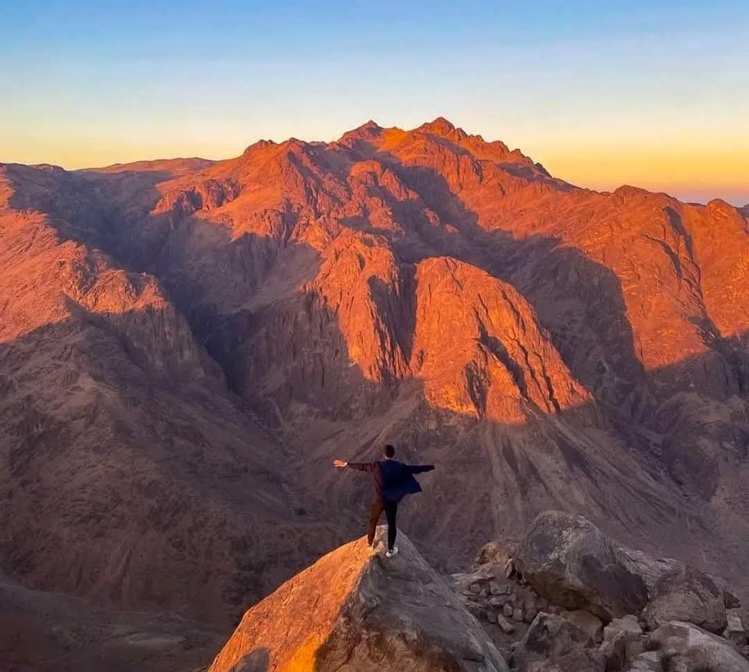
There are two ways up, and they meet near the top. The camel path, Siket El Bashait, is a wide graded track winding up the eastern flank in about two and a half hours on foot. You can ride most of it, though walking is usually faster, and riders dismount roughly a kilometre below the summit. The alternative is the Steps of Repentance, around 3,750 rough stone steps cut into the ravine behind the monastery by monks as an act of penance: shorter, far steeper, and anywhere from 45 minutes to three hours depending on your legs.
Both routes converge at Elijah's Hollow, the natural amphitheatre also called the Basin of the Seventy Elders, where there is a teahouse. From there a final flight of roughly 750 steps, about half an hour, reaches the top. On the summit stand a small Greek Orthodox chapel of the Holy Trinity, built in 1934 on sixteenth-century ruins, and a mosque still used by Muslims. The mountain is sacred in all three Abrahamic traditions, which is why the summit crowd is so mixed.
Worth saying plainly: identifying Jabal Musa as the biblical Mount Sinai rests on Byzantine tradition rather than archaeology, and scholars have proposed rival candidates elsewhere in Sinai and in Arabia. The pilgrimage is ancient; the geography is contested.
Pro Tip: Getting the Summit Timing Right
Groups leave the trailhead between midnight and 3am for sunrise, and the last hour becomes a queue on the steps. Climb on a night before a Friday or a Sunday, when the monastery is closed and day tours thin out, and the summit is markedly quieter. A late-afternoon ascent for sunset, a night in a St Catherine camp and the monastery next morning is the other way round the crush, and you descend in daylight.
Warning: The Cold at 2,285 Metres
The commonest mistake is packing for the Red Sea and then walking up a mountain. St Catherine town has hit −6 C (21 F) in February; the summit sits another 700 metres higher and is routinely below freezing at dawn in winter, with wind on top of that. Bring an insulating layer, a windproof shell, hat, gloves and a headlamp with fresh batteries, because phone torches fail on a three-hour descent. Check your insurance too: some policies impose an altitude ceiling, and cover for hiking to 3,000 m and helicopter evacuation is worth confirming.
Mount Catherine, Egypt's Highest Peak
Jabal Katrina, a few kilometres southwest of Jabal Musa, is the highest ground in Egypt, though published elevations disagree by more than 20 metres: figures between 2,629 m and 2,653 m are all in circulation, with 2,642 m the number the Bedouin trail cooperative uses. The route leaves the monastery, crosses the el-Milga plain and reaches the Monastery of the Forty Martyrs, Deir al-Arbain, in about an hour; from there it is roughly four hours to a summit chapel built in 1905 beside a small meteorological station. A guide is required and few work this route, so arrange it a day ahead.
Jabal Musa is not even the highest peak in its own neighbourhood: Om Shomer at 2,583 m and Abbas Basha at 2,383 m both overtop it. The surrounding high desert holds Nubian ibex and the Sinai baton blue, often called the world's smallest butterfly, protected since 1988 within the St Katherine Protectorate.
The Colored Canyon, the White Canyon and Ain Khudra
Inland from Nuweiba the sandstone breaks into narrow slot canyons. The Colored Canyon, in Arabic al-Wadi al-Mulawwan, is a labyrinth roughly 800 metres long with walls reaching about 40 metres, streaked in iron-stained bands of red, purple, ochre and near-white. It sits about 90 km north of Dahab and is usually a half-day jeep trip with a short scramble, often combined with the nearby White Canyon, pale chalky limestone rather than banded sandstone.
Nearby, Ain Khudra, also written Ein Hudera, is a small palm oasis traditionally identified with the biblical Hazeroth, and the natural lunch stop on canyon trips. Two cautions apply in the slots: they are flash-flood channels, so never enter when rain is forecast upstream, and there is no shade or water inside, which matters far more in May than in January.
The Sinai Trail: Egypt's First Long-Distance Path
The Sinai Trail launched in 2015 as a 220-kilometre, 12-day route run by three Bedouin tribes, and was voted the best new tourism project in the world at the British Guild of Travel Writers awards in 2016. It has since grown into a 550-kilometre circuit taking 54 days end to end, worked by eight tribes: the Tarabin, Muzeina, Jebeleya, Awlad Said, Gararsha, Sowalha, Hamada and Alegat. Most people walk a section.
The classic leg runs from Ras Shetan on the Gulf of Aqaba to the St Catherine highlands in twelve days, four with each of three tribes, handing over at Ain Khudra and Wadi Fara. Its stated length varies between 210 and 230 km depending on which page of the cooperative's own material you read. Other sections climb Om Shomer and Jabal Katrina, or run west to Serabit el-Khadim, the Middle Kingdom turquoise-mining district whose Temple of Hathor was founded under Senusret I, and where Flinders Petrie recorded the Proto-Sinaitic inscriptions, among the earliest alphabetic writing known. Their date is disputed, with serious arguments for around 1850 BC and around 1550 BC.
Camels carry the water, food and kit, hikers carry a daypack, guides are not optional, and trips run September to May. One caution: the project's original web address lapsed years ago and now resolves to unrelated commercial content, so verify any Sinai Trail contact before sending money. On what those days with Bedouin hosts are like, see our guide to Bedouin culture and desert hospitality.
Permits, Checkpoints and What the Advisories Say
Here is the specific wording, because travellers routinely misread it. The UK Foreign Office advises against all travel to North Sinai Governorate. Separately, it advises against all but essential travel to the northern part of South Sinai Governorate beyond the St Catherine to Nuweiba road, except for the coastal areas on the west and east of the peninsula. Read carefully, that line falls north of the places in this article: St Catherine, Mount Sinai, the coastal towns and the roads linking them sit outside the advise-against zone, and the FCDO describes southern Sinai's Red Sea tourist areas as generally low risk. It adds that anyone driving a 4x4 in from the mainland through the Suez crossing needs a permit from the Travel Permits Department of the Ministry of the Interior, and recommends booking activities outside resort areas through approved operators.
Expect several police and army checkpoints on any inland drive, carry your passport rather than a photocopy, and expect your operator to submit passenger names in advance. Advisories change, so read your government's current text alongside our notes on desert safety and permits in Egypt.
Weather Month by Month in the High Sinai
St Catherine has the coldest nights of any town in Egypt. Mean daily maximums run about 13.8 C (57 F) in January and 32 C (90 F) in July and August, but the minimums matter more: roughly 1.7 C (35 F) in January and only 7.4 C (45 F) in November. Annual rainfall is around 21 mm, essentially nothing, but what falls arrives suddenly. March to May and September to November are the comfortable windows; midsummer punishes anyone on an exposed canyon walk, and deep winter brings snow to the high ground.
What to Pack for the Interior
- Broken-in hiking shoes or sturdy trekking sandals. Sinai granite and flint destroy flimsy trainers.
- A warm mid-layer, windproof shell, hat and gloves from November to March, and something warm even in autumn.
- A headlamp with spare batteries for any night ascent, and a power bank.
- At least two litres of water per person for a half-day canyon walk.
- Cash in small Egyptian notes for guide fees, tea, the museum and tips. Card acceptance inland is unreliable.
- Modest dress for the monastery: covered shoulders and knees, for all genders.
Planning a Sinai Trip
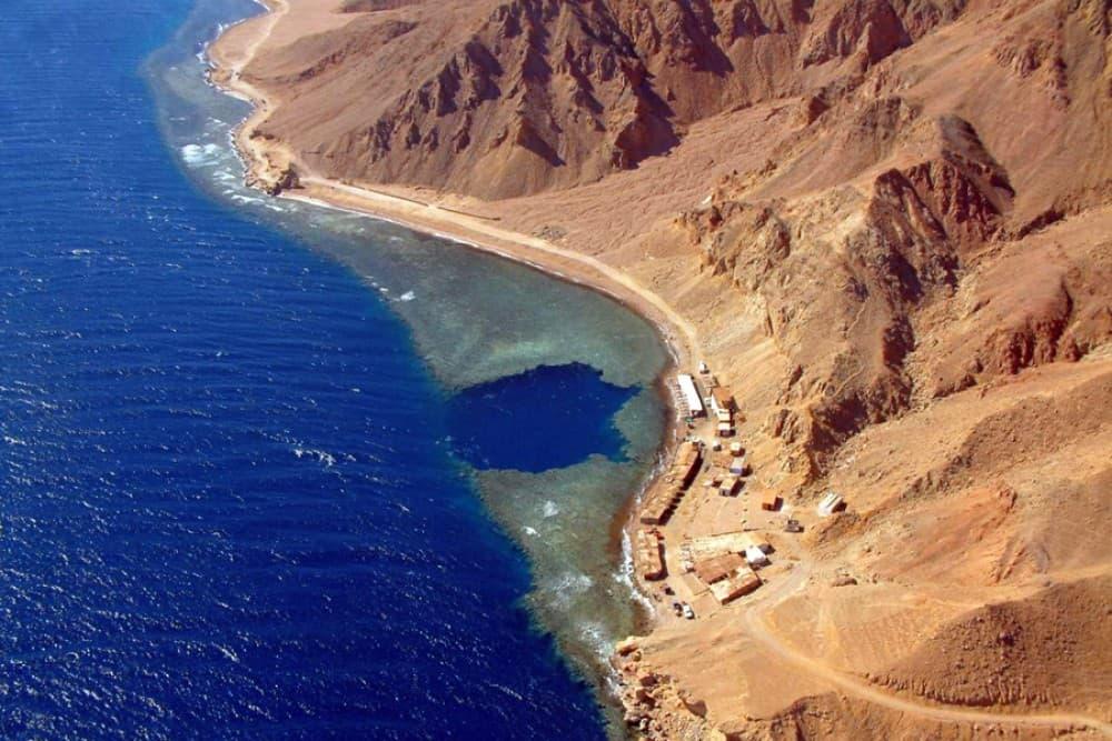
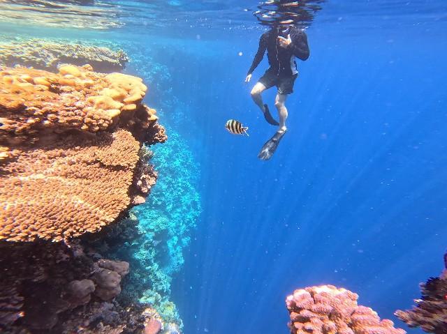
The interior works best as a two- or three-day insert into a Red Sea week: two nights on the coast, an overnight run up Jabal Musa, a full day for the monastery and the canyons, then back to the water. Snorkelling days bookend it neatly, whether that is the sinkhole and reef wall on our Dahab Blue Hole trip or the protected reefs on the Ras Mohammed day from Sharm, and a Sharm airport transfer keeps arrival day simple. The wider Red Sea region page shows how the coastal bases connect.
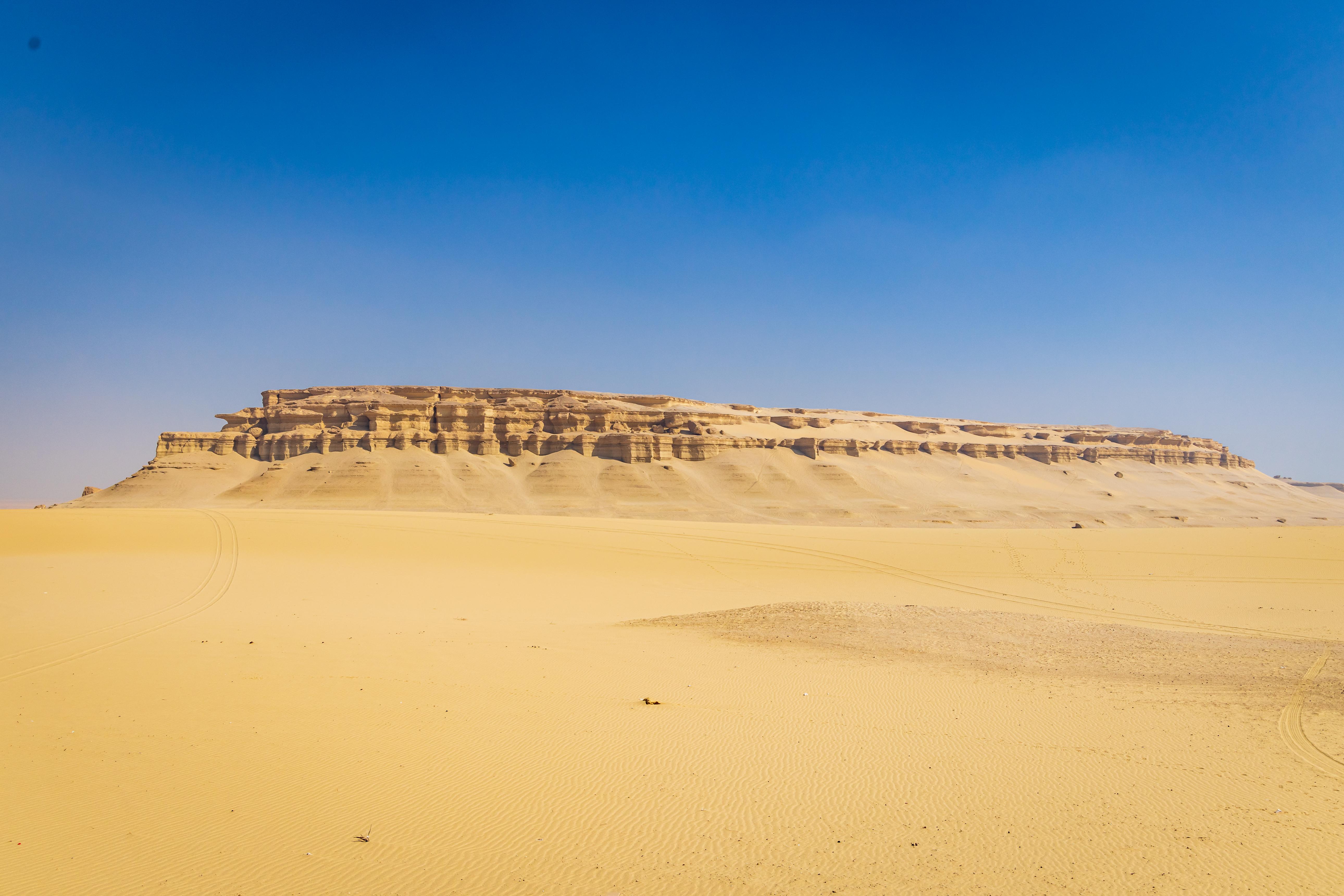
If the mountains pull harder than the reefs, it helps to see how unlike this desert is to the country west of the Nile. The White Desert and Siwa are soft, pale and horizontal; Sinai is granite, vertical and cold after dark. Christian monasticism began in that western landscape too, and our guide to Egypt's desert monasteries traces the line running to the walls at the foot of Jabal Musa. Give the interior more than one sunrise and it stops being a stop on a beach holiday.