About sixty kilometres inland from Hurghada, at roughly 700 metres of altitude in the Red Sea Hills, a granodiorite column blank weighing something close to two hundred tonnes lies exactly where it split. Nobody moved it. The quarry gang that had spent months freeing it from the mountain looked at the fracture, walked away, and cut another one instead. That replacement went down a graded road to the Nile at Qena, onto a barge, downriver, across the Mediterranean to Ostia and up to Rome. The failed column is still on the hillside, still split, with wedge slots and chisel marks legible on it eighteen centuries later.
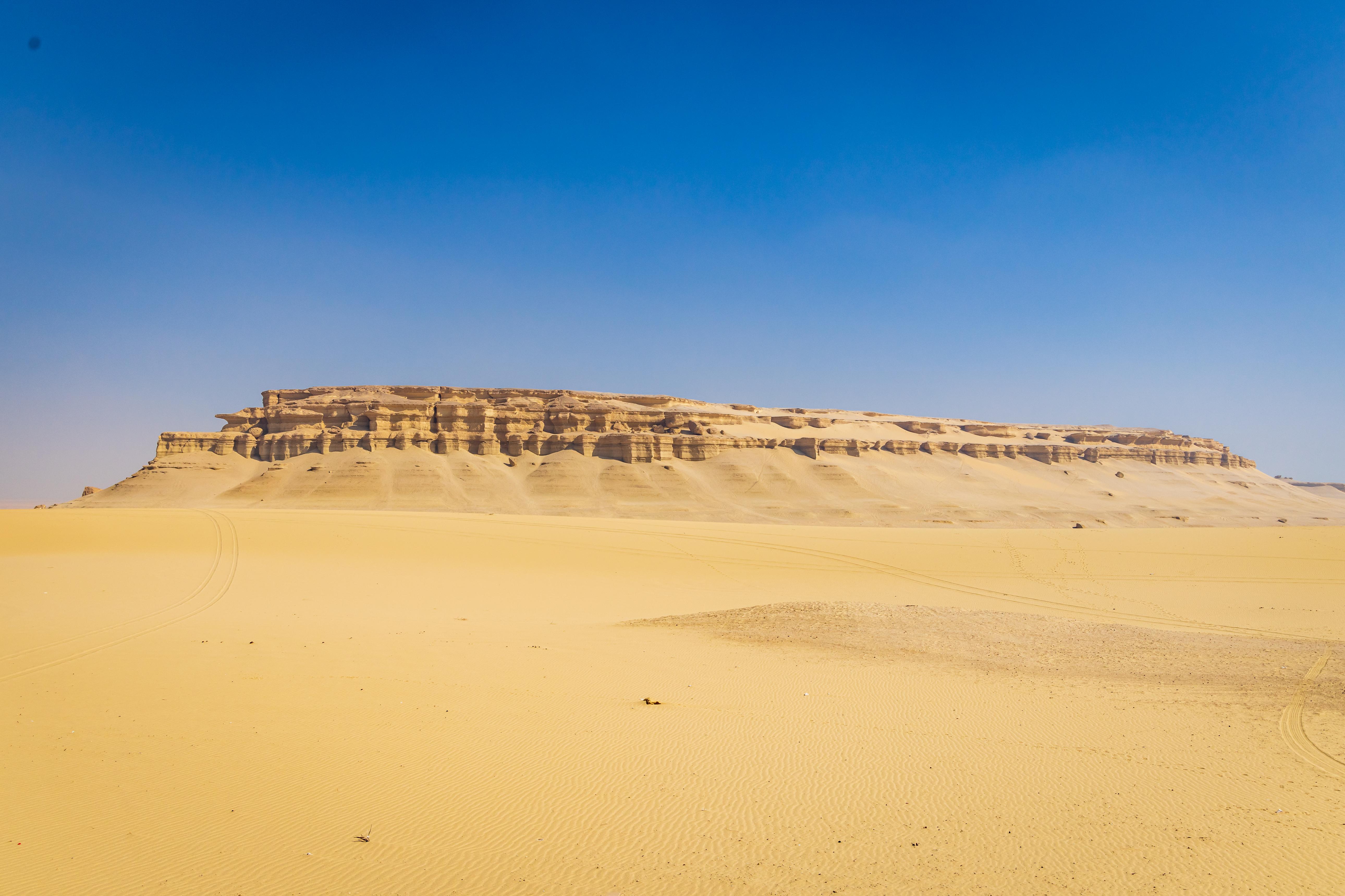
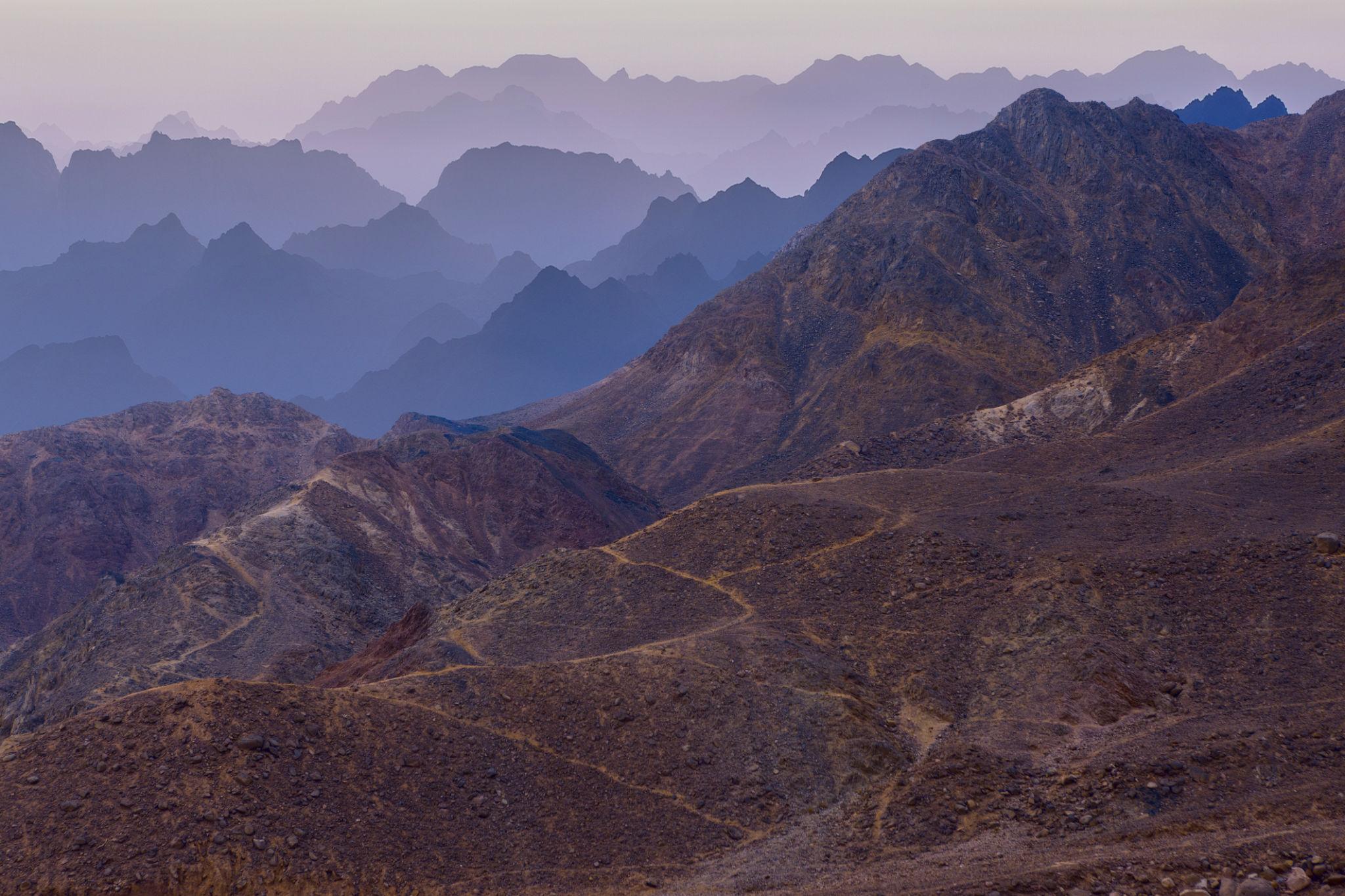
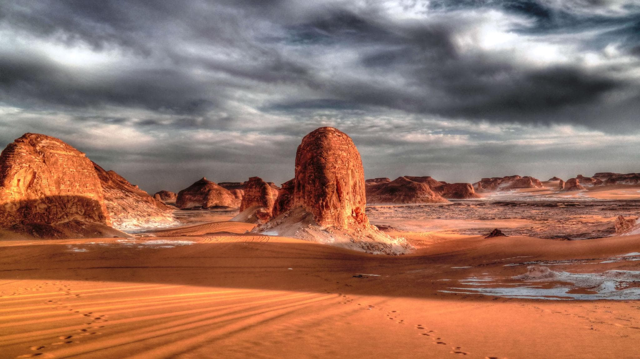
This is Egypt's Eastern Desert, and it is the part of the country visitors fly over without noticing. It is not sand. Between the Nile Valley and the Red Sea lies a belt of black and red mountains — granite, granodiorite, basalt, porphyry — cut by dry riverbeds draining east to the coast and west to the river. The Egyptian section holds the highest mountain in mainland Egypt, Gebel Shayib el-Banat, at 2,184 metres.
For roughly five centuries this was the most industrialised landscape in the Roman world outside Italy. Rome ran imperial quarries here for stone it could get nowhere else, built roads and wells to service them, and used the same corridors to move Indian pepper and East African ivory from Red Sea ports to the Nile. Almost all of it is still standing, unfenced and unrestored, an hour or three from a beach resort. Here is what is out there, and what a traveller can honestly expect to reach.
At a Glance
Where: The mountain belt between the Nile and the Red Sea, running from the Gulf of Suez south to the Sudanese border
Coastal gateways: Hurghada, Safaga (53 km south of Hurghada), El Quseir (138 km south) and Marsa Alam (274 km south)
Nile gateways: Qena, Qift and Edfu, all on the paved cross-desert roads
Headline sites: Mons Porphyrites, Mons Claudianus, Wadi Hammamat, Wadi Sikait, Berenike
Best months: November to March. Hurghada averages a daily high near 22C (72F) in January against 37.5C (100F) in August
Rainfall: Under 25 mm a year — but it arrives as flash floods in the wadis
Access: Wadi Hammamat sits on asphalt. Everything else needs a 4x4 and a local driver
Permits: The UK Foreign Office advises anyone travelling off-road in Egypt to use a qualified guide and obtain a permit from the Ministry of Interior
The Land Between the Nile and the Sea
The Red Sea Hills are the shoulder of a rift. The land tilted during the Oligocene, roughly 34 million years ago, and the sea opened along the fracture, leaving a spine of Precambrian igneous and metamorphic rock exposed near the coast. That is the whole reason Rome came: the oldest, hardest and strangest-coloured stone in the Mediterranean world was sitting on the surface here and almost nowhere else.
People have used this ground for a very long time — flint tools from the region go back some 250,000 years, and the wadis carry rock art running from the predynastic period to the twentieth century. What changed under Rome was scale. Quarrying stopped being an expedition and became an occupation, with permanent settlements, garrisons, water infrastructure and a supply chain reaching back to the river.
Mons Porphyrites and the Only Purple in the Empire
Gebel Abu Dukhan — the name means roughly "father of smoke", for the cloud that often caps it — sits about fifty kilometres inland from Hurghada in a straight line. The Romans called it Mons Porphyrites, and it was the only known source anywhere of imperial porphyry, the deep purple stone with pale plagioclase crystals scattered through it.
An inscription dates the discovery to AD 18, crediting a Roman official named Caius Cominius Leugas. Purple was the imperial colour, so the stone became imperial property, and for four centuries it went almost exclusively into things that asserted power: emperors' sarcophagi, the Tetrarchs group now embedded in the corner of St Mark's in Venice, Constantine's column in Istanbul. Ostraca from the site record activity into the 430s. Quarrying stopped after the fifth century and the location was lost to Europe until English travellers reached it again in 1823.
The site sprawls over about nine square kilometres. The central complex sits at 630 metres and holds a fort, a workers' settlement, a bathhouse with a hypocaust, blacksmith workshops, two wells, a large cistern and a cemetery. There are temples to Isis dated to AD 113 and AD 137-138, a temple to Sarapis of AD 117-119, and an earlier one to Pan. Five separate villages housed the workforce, and the highest quarry, called Rammius, is up at 1,438 metres. Getting stone off that slope and onto the coastal plain was the real engineering achievement, and the ramped loading slipways are the most impressive thing still visible.
Mons Claudianus and the Column That Never Left
Mons Claudianus lies roughly 120 kilometres east of the Nile and about sixty southwest of Hurghada, at around 700 metres. Its stone is a speckled grey-and-black granodiorite the Italians later christened granito del foro. If you have stood under the portico of the Pantheon in Rome, you have stood under columns cut here. The same stone went into Hadrian's Villa at Tivoli and Diocletian's Palace at Split.
Working ran from the first century AD to the middle of the third. The settlement housed something like a thousand people at its peak, under military administration, with a fort, animal lines and a well. Column blanks of up to two hundred tonnes still lie about the site, several of them cracked and abandoned. Anyone who has seen the Unfinished Obelisk in Aswan will recognise the scene instantly: the same drama of a colossal object defeated by a flaw in the rock, left in place because moving a failure was pointless.
Good to Know: The Quarry Workers Were Paid Well
The popular image of Roman quarries is chain gangs and condemned criminals. The ostraca from Mons Claudianus — thousands of scraps of inscribed pottery recording rations, wages, requisitions and private letters — say something different. The skilled workers were paid, and paid roughly double what comparable labourers earned elsewhere, with grain rations on top.
The food debris tells the same story. Excavators found black pepper from India and fish carried up from the Red Sea. These were not starvation camps. They were remote, hard, hot company towns with a decent pay packet, which is why the empire could keep them staffed 120 kilometres from the nearest river.
The Roads, the Wells and the Via Hadriana
None of this worked without water. The Roman answer was the hydreuma: a fortified well station, spaced roughly a day's travel apart along each quarry road, walled and garrisoned so that a caravan could reach the next one before its water ran out.
Deir el-Atrash is the most legible of them, sitting in Wadi el-Atrash on the road from Qena out to Mons Porphyrites and on to the coastal fort at Abu Sha'ar. It is a square of graywacke blocks about 55 metres on a side, with corner towers, a central well pit and an animal annex, occupied in the late first and early second centuries and again in the late fourth and early fifth. In 2020 archaeologists reported polychrome wall paintings there showing a mounted rider, a camel caravan and vine motifs — an unusual survival for a desert fort.
The most ambitious road was the Via Hadriana, completed in AD 137, running from Antinoöpolis on the Nile across to the coast and then south along the Red Sea to Berenike. Its traces were noted by European surveyors in 1910 and 1925 and systematically walked by University of Delaware teams in the 1990s. Long stretches are still visible from the air as cleared lines with cairns.
Myos Hormos, Berenike and the Indian Ocean Run
The quarry roads doubled as trade roads. Myos Hormos, now identified with the site of Quseir al-Qadim about eight kilometres north of modern El Quseir, was founded under Ptolemy II and became the northern hinge of the Indian Ocean trade. Strabo reports that under Augustus as many as 120 ships a year were sailing from Myos Hormos to India. Excavation there has turned up texts in Tamil, Greek, Latin, South Arabian, Nabataean and Palmyrene, which is about as cosmopolitan as a Red Sea fishing beach has ever been.
Berenike, founded in 275 BC by Ptolemy II and named for his mother, sits roughly 140 kilometres south of Marsa Alam and 260 kilometres east of Aswan. A desert road of 258 Roman miles connected it to Coptos on the Nile, watering stations and all. Excavations have produced Tamil-Brahmi inscriptions, concentrations of black peppercorns, a Ptolemaic fortress associated with shipping war elephants up from the Eritrean coast, and — in 2022 — a marble Buddha in the forecourt of the Isis temple. The port faded after the sixth century and the harbour silted up.
Be realistic about Berenike, though. It sits beside the active Ras Banas military installation, and it is not a site you can decide to visit on the morning of your holiday.
The Emerald Mines of Wadi Sikait
Inland from Marsa Alam, inside Wadi El Gemal National Park, is Mons Smaragdus — the only emerald source in the entire Roman Empire, and the oldest emerald mining district known anywhere. Work at the Sikait settlement began in the third century BC under the Ptolemies and peaked in the Roman and Byzantine periods. The Romans built a temple to Serapis there. The French traveller Frédéric Cailliaud found the workings again around 1817, guided by a reading of Pliny.
Two honest caveats. The popular name "Cleopatra's Mines" reflects a plausible association rather than a documented one. And Roman smaragdus was beryl of very variable quality, often pale and included, so nobody should picture Colombian-grade stones coming out of these shafts. Sources also differ on how far inland Sikait actually lies, with figures from roughly 25 to 45 kilometres quoted, because the mining district is scattered across several side wadis rather than concentrated at one point.
The park itself covers about 7,450 square kilometres of land and sea and was established in 2003. A gate fee applies, payable in cash. It has been a modest sum in EGP terms but has been revised more than once, so confirm the current rate on the day rather than budgeting from an old article.
Wadi Hammamat: The Ancient Road You Can Drive
If you only reach one Eastern Desert site, make it this one, because the asphalt goes to the door. The Qift-to-Quseir road runs about 195 kilometres across the mountains, and Wadi Hammamat sits roughly halfway.
The wadi's greenish metagreywacke, called bekhen-stone by the Egyptians, was quarried for palettes, bowls, statues and sarcophagi from the predynastic period onward, and the stone of the Narmer Palette is generally traced to these beds. The rock faces carry inscriptions running from before the First Dynasty to the modern era, including boat drawings dated to around 4000 BC and the only known painted petroglyph from the Eastern Desert. The Turin Papyrus Map, a Ramesside plan usually identified as showing this stretch of wadi with its quarries and gold workings, is often called the oldest surviving geological map in the world.
The Ababda and the People of the Hills
The Eastern Desert is inhabited, and has been continuously for millennia. The Ababda, an Arabised Beja people numbering over 250,000, hold ground running from around Qena in the north down towards Berber in Sudan, and from Halayeb across to Hurghada. They spoke Beja historically and shifted mainly to Arabic during the nineteenth century. Their jabana coffee, roasted with ginger and poured from a long-necked clay pot, is a genuine institution, and their sword-and-shield dances, shakreeb and hosheeb, are still performed.
South and east of them the Bisharin still speak Beja itself, which they call Bidhaawyeet, a Cushitic language with no relation to Arabic. Both groups are generally accepted as descendants of the Blemmyes, the Eastern Desert people who appear in written sources from the seventh century BC to the eighth century AD, who fought Rome repeatedly and extracted an annual gold payment from Diocletian in AD 298. If you want more on desert hospitality and how to be a decent guest in it, our guide to Bedouin culture in Egypt goes further.
Warning: Permits, Flash Floods and a Closed Trail
Three practical realities to absorb before you plan anything.
- Permits are not optional. The UK Foreign Office advice for Egypt is explicit that off-road travellers should use a qualified guide and obtain a permit from the Ministry of Interior. Coastal resorts and the main paved roads are routine; the mountains behind them are not. Our post on desert permits and choosing an operator covers the paperwork properly.
- Flash floods kill people here. The region gets under 25 mm of rain a year, but it can arrive in an hour, and a dry wadi is a drainage channel. Never camp in a wadi floor when rain is forecast anywhere in the catchment, and take a driver's decision to turn around seriously.
- The Red Sea Mountain Trail, the Bedouin-run hiking route that took walkers to Gebel Abu Dukhan and the porphyry quarries, suspended operations in November 2024 after five years, its organisers stating that hiking permits had become effectively unobtainable. It had not reopened as of 2026. Anyone who reads about hiking this range needs to check its current status before building a trip around it.
What You Can Realistically See from Hurghada or Marsa Alam
Nobody sells a ticket to Mons Porphyrites. What you are buying is a vehicle, a driver who knows the wadi, and the permit paperwork, and it is quoted per car rather than per head, so get more than one quote. Sensible options, roughly in order of how easy they are to arrange:
- Wadi Hammamat, as a stop on the drive between the coast and the Nile. It adds an hour to a transfer you were making anyway.
- A full-day 4x4 run into the hills behind Hurghada towards Abu Dukhan, subject to permits on the day.
- Wadi Sikait and the inland wadis of Wadi El Gemal, arranged through the park from the Marsa Alam side.
- Quseir's Ottoman fort and the coast road, for a low-effort half day with real history in it.
Most people arrive on a Red Sea beach holiday, which makes Hurghada airport transfers and Marsa Alam airport transfers the natural first booking, and the desert an add-on decided once you are on the ground. If you would rather see the Eastern Desert as a landscape than as an archaeological site, the Hurghada to Luxor day trip crosses the whole range and is the cheapest way to understand its scale. Travellers wanting more time in the hills often take a private Hurghada to Luxor transfer instead and ask the driver to stop.
Insider Tip: How to Read a Roman Quarry
Quarries look like rubble until you know the vocabulary, and then they become extremely readable. Four things to look for.
- Wedge slots: neat rectangular sockets in a line along a block face, where iron or wooden wedges were driven to split the stone. They tell you the direction of the intended break.
- Slipways and loading ramps: graded stone causeways running downhill, often with retaining walls. These moved the blocks, and at Mons Porphyrites they are the most visible surviving structure.
- Abandoned blanks: anything half-cut and left in place failed. Look for the crack; it is usually obvious once you have found one.
- Spoil heaps and hut circles: the small dry-stone rings on the slopes above the quarries are where the gangs slept, and they are where the pottery is.
Take nothing. Porphyry chips and emerald-bearing beryl fragments are attractive and picking them up is both illegal and the reason unprotected sites degrade.
Planning the Eastern Desert Into a Bigger Trip
The Eastern Desert works best as connective tissue rather than a destination in its own right. It sits physically between the Red Sea coast and Luxor, so almost any itinerary that includes both already crosses it — the question is only whether you stop. Two or three days on the coast with one desert day inserted is the pattern that works for most people, and it pairs naturally with a snorkelling day such as Giftun Island so you are not doing back-to-back heat.
From the southern end, the paved road inland from Marsa Alam reaches the Nile near Edfu, which makes an Edfu and Kom Ombo temple day a logical continuation rather than a separate trip. For the coastal logistics either side of your desert day, our Hurghada travel guide and Marsa Alam guide cover where to base yourself.
Come between November and March, budget a full day for anything beyond the asphalt, and sort permits before you fly rather than in a hotel lobby. The stone is not going anywhere, but the paperwork takes longer than the drive.